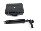
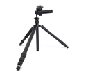
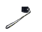
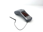
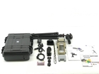
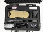
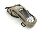
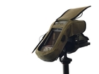
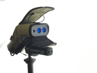
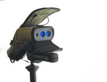
MapSight with all the accessories including the tripod stand. You get all the accessories shown in the photos.
GE MapSight: Measure, Map & Model
Verifiable. MapSight provides geo-tagged photo verification of all field work. Every measurement is embedded directly into the MapSight photograph. Providing time stamped visual evidence establishes location and proof of attachment status.
Accuracy. The attachment heights are accurate to within ±1”. Additionally, from a safe location, your MapSight laser measures the GPS location of your poles to within ±3 feet.
Standardization. The software is designed to easily create customized forms that ensure consistency in data collection. The data can also be generated in a variety of industry standard formats, including Google Earth, which can then be imported into back-office software.
Efficiency. Our unique all-in-one device combines laser rangefinder, digital camera and compass, along with GPS and a mobile computer. You carry less equipment in the field.
Productivity. Field data collection time is greatly improved using MapSight. Users are able to collect and process utility pole data and measurements faster than conventional methods.
Safety and Access. Enables users to stand in a safe location to capture pole and overhead line measurements. MapSight also enables you to take measurements in hard to access areas. No more standing in the middle of a street or letting a fence block your access to the pole.
***15 identical units available!
Finance it, quickly
Apply Now
Only takes 3 minutes